


John Sailors, Publishing Projects
Dashing Globe
Mappa Merch


Coming soon!

Dashing Globe Map Merch
Date: 1519.
Creators: Attributed to Lopo Homem, Jorge Reinel, and Pedro Reinel, with illuminations by Antonio de Holanda.
LOC Tiltle: Nautical Atlas of the World, Folio 3 Recto, Northern Indian Ocean with Arabia and India and Folio 3 Verso, Southern Indian Ocean with Insulindia on the Left, and Madagascar on the Right.
See the redbubble product page.

Library of Congress Description: The map presented here is from the Miller Atlas in the collections of the National Library of France. Produced for King Manuel I of Portugal in 1519 by cartographers Pedro Reinel, his son Jorge Reinel, and Lopo Homem and miniaturist António de Holanda, the atlas contains eight maps on six loose sheets, painted on both sides. The maps were richly decorated and illuminated by António de Holanda, a Dutch native who had been in Portugal for nearly ten years. The illustrations include ornate images of castles, towns, and architectural wonders; views of forests and other vegetation; and depictions of native peoples and animals. The shapes of some towns and coastlines are quite detailed. For other parts of the world about which Europeans still had limited knowledge, geographic details are drawn from the cartographer's imagination or informed by views that originated with Ptolemy. One side of the map (folio 3 recto of the atlas) shows the Northern Indian Ocean with Arabia and India. The equator is shown; other features include the Red Sea, Gulf of Aden, Persian Gulf, Ganges Delta, and the Nicobar Islands. The reverse side (folio 3 verso) depicts the southern Indian Ocean with Insulindia (maritime Southeast Asia) on the left and Madagascar on the right. Both sides of the map have ornamental gold leaf, red banners with gold lettering for place-names, heraldic shields and flags, and vessels flying either the Portuguese Cross of the Order of Christ or the Ottoman crescent. The atlas takes its name from Emmanuel Miller, who purchased it in 1855 from a bookseller in Santarém, Portugal. Miller's widow sold it to the National Library of France in 1897.


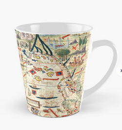


Date: 1519.
Creators: Attributed to Lopo Homem, Jorge Reinel, and Pedro Reinel, with illuminations by Antonio de Holanda.
LOC Tiltle: Nautical Atlas of the World, Folio 3 Recto, Northern Indian Ocean with Arabia and India and Folio 3 Verso, Southern Indian Ocean with Insulindia on the Left, and Madagascar on the Right.
See the redbubble product page.
Library of Congress Description: The map presented here is from the Miller Atlas in the collections of the National Library of France. Produced for King Manuel I of Portugal in 1519 by cartographers Pedro Reinel, his son Jorge Reinel, and Lopo Homem and miniaturist António de Holanda, the atlas contains eight maps on six loose sheets, painted on both sides. The maps were richly decorated and illuminated by António de Holanda, a Dutch native who had been in Portugal for nearly ten years. The illustrations include ornate images of castles, towns, and architectural wonders; views of forests and other vegetation; and depictions of native peoples and animals. The shapes of some towns and coastlines are quite detailed. For other parts of the world about which Europeans still had limited knowledge, geographic details are drawn from the cartographer's imagination or informed by views that originated with Ptolemy. One side of the map (folio 3 recto of the atlas) shows the Northern Indian Ocean with Arabia and India. The equator is shown; other features include the Red Sea, Gulf of Aden, Persian Gulf, Ganges Delta, and the Nicobar Islands. The reverse side (folio 3 verso) depicts the southern Indian Ocean with Insulindia (maritime Southeast Asia) on the left and Madagascar on the right. Both sides of the map have ornamental gold leaf, red banners with gold lettering for place-names, heraldic shields and flags, and vessels flying either the Portuguese Cross of the Order of Christ or the Ottoman crescent. The atlas takes its name from Emmanuel Miller, who purchased it in 1855 from a bookseller in Santarém, Portugal. Miller's widow sold it to the National Library of France in 1897.
Redbubble.com
Map of the Indian Ocean and East Africa from the Miller Atlas (1519), commissioned by Portugal's King Manuel I. By Lopo Homem, Jorge Reinel, Pedro Reinel and Antonio de Holanda.
See the redbubble product page.
Coming soon!
Library of Congress Description:
Creators: Attributed to Lopo Homem, Jorge Reinel, and Pedro Reinel, with illuminations by Antonio de Holanda.
LOC Tiltle: Nautical Atlas of the World, Folio 3 Recto, Northern Indian Ocean with Arabia and India and Folio 3 Verso, Southern Indian Ocean with Insulindia on the Left, and Madagascar on the Right.
See the redbubble product page.
The mappa mundi, portolan charts, and other maps of the medieval and Renaissance periods are inspirational both in their artistic qualities and in the quandaries and questions their cartographers were addressing: What shape was the earth? How much of it was habitable? Was the Indian Ocean landlocked? Could one sail west to get to the east? Where were the exotic places like Ophir and Tarshish, Solomon's sources of gold and spices, that Ptolemy and others named? Importantly, how can you draw a map of the world without all these answers?
Other questions they might have asked: Where does the client want these places to be located? Is the client paying extra for sea monsters? And importantly for some, what will my local bishop and priests think?
Early modern maps show emerging mental concepts as cartographers sorted through the clash of (1) fixed dogma of Christian geographical teachings, (2) rediscovered geographical knowledge of classical writers like Ptolemy and Strabo, and (3) new, empirical evidence from the likes of Marco Polo and Niccolò de' Conti that was far from in accord with (1) and (2)—and in the process they developed modern worldviews vastly different from those of only a century or two before.
Many of the most magnificent and historically important maps are available online from sources such as Wikimedia Commons and the Library of Congress. High-resolution copies, sometimes in multiple formats, can be downloaded to study and appreciate. Going a step further, one can use inexpensive print-on-demand sites like Redbubble to create wall prints, coffee mugs, clocks, mouse pads, and other products to enjoy and study.
The Dashing Globe Map Merch Collection is being put together to offer a combination of educational, artistic products for home, office, or school that celebrate the intellectual and artistic achievements of medieval and early modern mapmakers at a time when their profession was novel, its very goals not yet gasped.
As for accuracy? Its very lack is often what makes these historical documents fascinating. Mistakes may show a general lack of knowledge or they may have been intentional, such as the large collection of nonexistent islands and shoals surrounding the Spice Islands on some maps, saying in effect, "This is where they are but you'll never be able to sail there." Inaccuracies may be politically motivated, as seen on Diogo Ribeiro's 1529 world map, sometimes called "the propaganda map," whose purpose was show conclusively that the Spice Island lay in Spanish, not Portuguese, waters.
Then there was that time in 1609 when Abraham Ortelius (1527–1598) decided to surround Iceland with outrageous mythical sea creatures, likely taken from Sebastian Münster's (1488–1552) Cosmographia of 1545 (the earliest German-language description of the world) and Münster's chart of Sea and Land Creatures. Ortelius's Islandia map became one of the most famous historical maps of the island, which was by all appearances was one dangerous place to sail.
Our collection is a new work in progress as we begin to curate offerings. The aim is quality educational products that don't cost, say, the price of a municipal bond issue … or a textbook in an American university.
To be continued . . .
.jpg)


.jpg)
The mappa mundi, portolan charts, and other maps of the medieval and Renaissance periods are inspirational both in their artistic qualities and in the quandaries and questions their cartographers were addressing: What shape was the earth? How much of it was habitable? Was the Indian Ocean landlocked? Could one sail west to get to the east? Where were the exotic places like Ophir and Tarshish, Solomon's sources of gold and spices, that Ptolemy and others named? Importantly, how can you draw a map of the world without all these answers?
Other questions they might have asked: Where does the client want these places to be located? Is the client paying extra for sea monsters? And importantly for some, what will my local bishop and priests think?
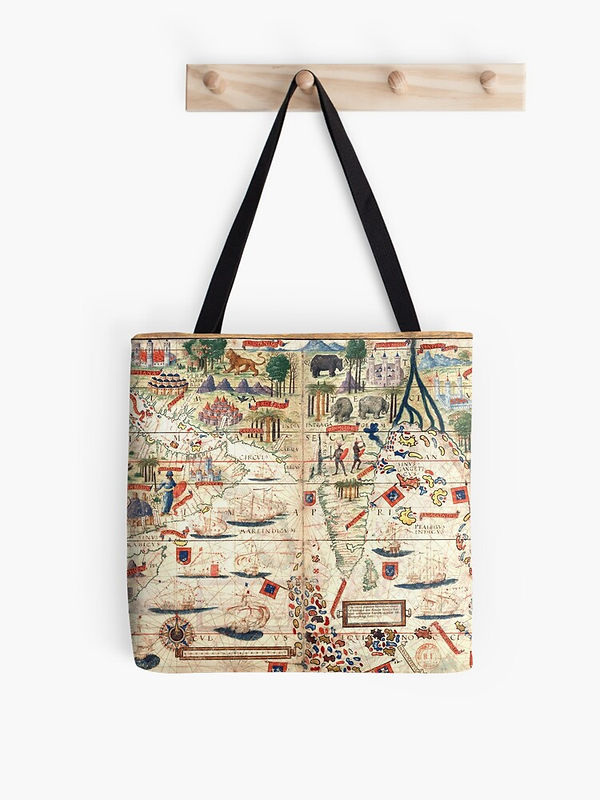
Map Merch: Miller Atlas, Indian Ocean
Map of the Indian Ocean and East Africa from the Miller Atlas (1519), commissioned by Portugal's King Manuel I. By Lopo Homem, Jorge Reinel, Pedro Reinel and Antonio de Holanda. See the redbubble product page.


Diogo Ribeiro's 1529 world map, Vatican Library. (Source).

Detail from Abraham Ortelius's Islandia. (Source).